SISJAC Digital Archives on Japanese Materials
  • About Us
  • A. Online Database
  • B. Digital Exhibition
    • JAPAN: Historical Images from the Cortazzi Collection Exhibition
  • C. Digital Spin-off
  • D. Links
    • D1 Institutions
    • D2 Sites for Research
  • Home
  • JAPAN: Historical Images from the Cortazzi Collection Exhibition
  • Section 4 Old Japanese Maps
Section 4 Old Japanese Maps

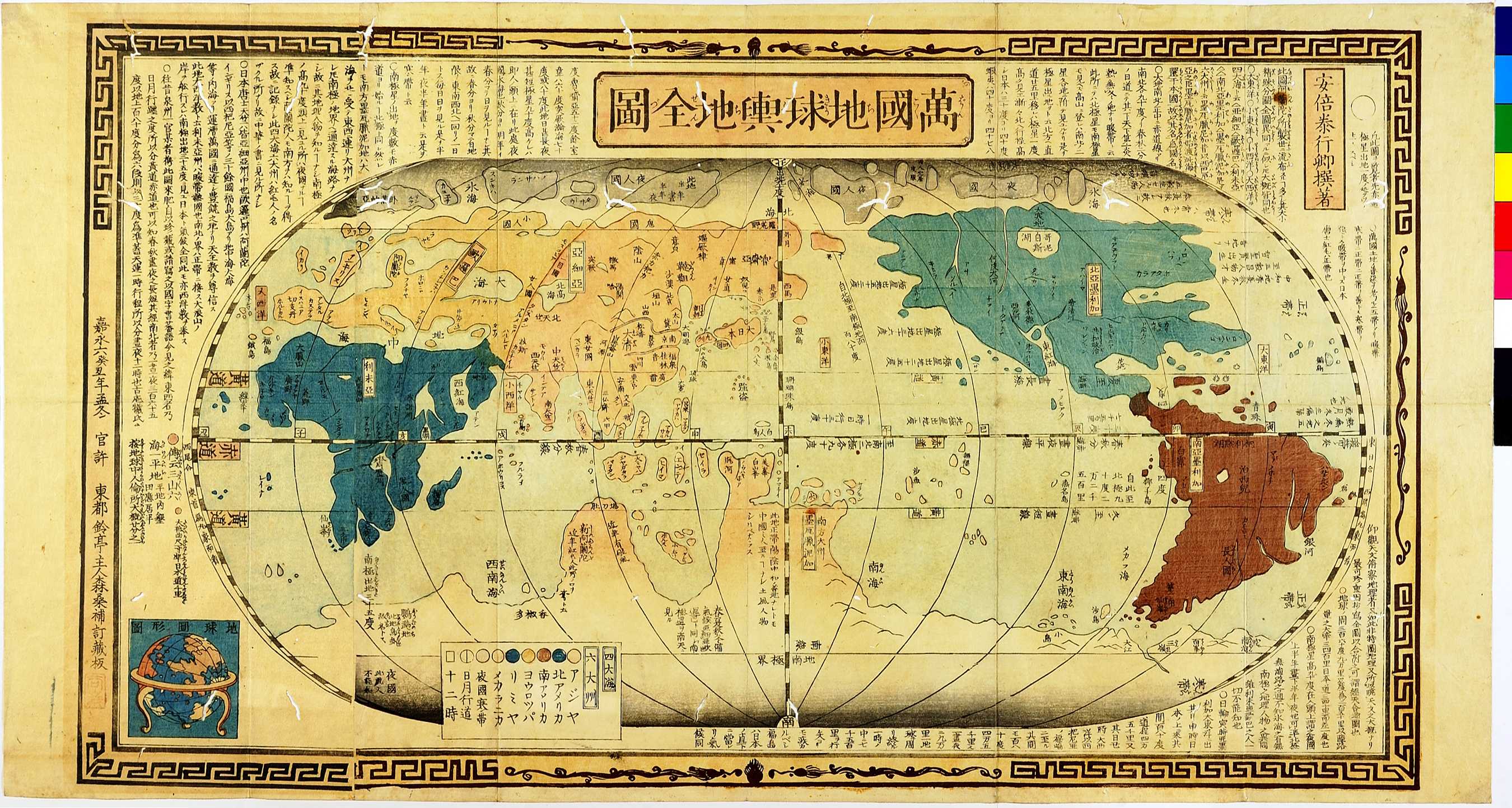
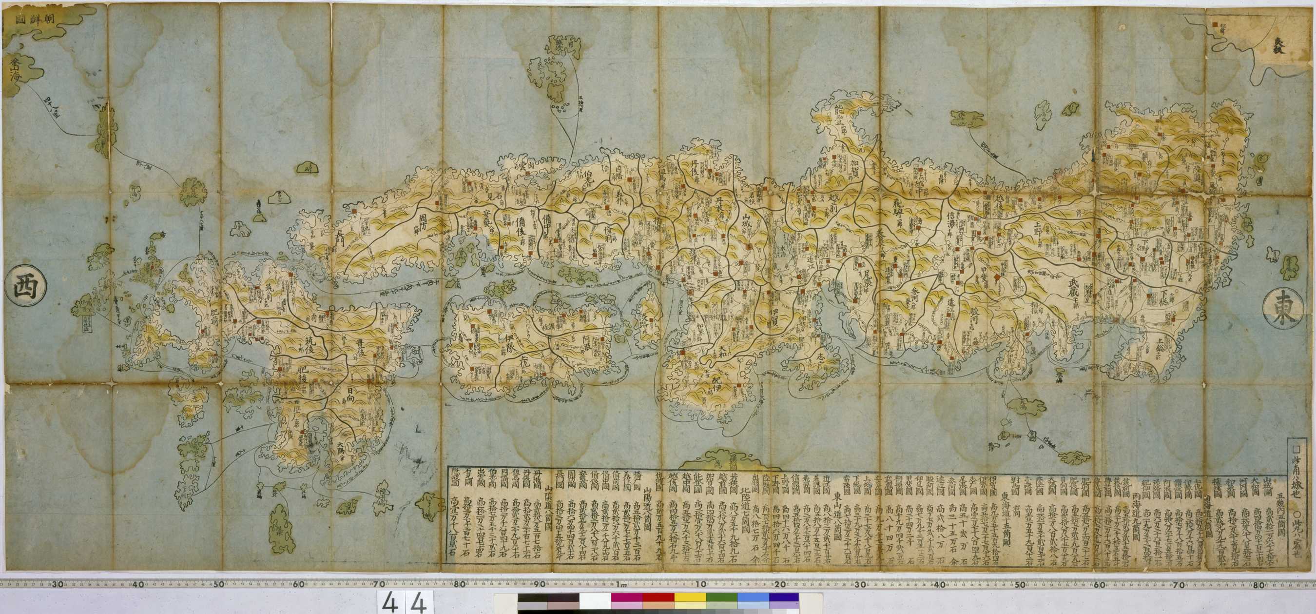
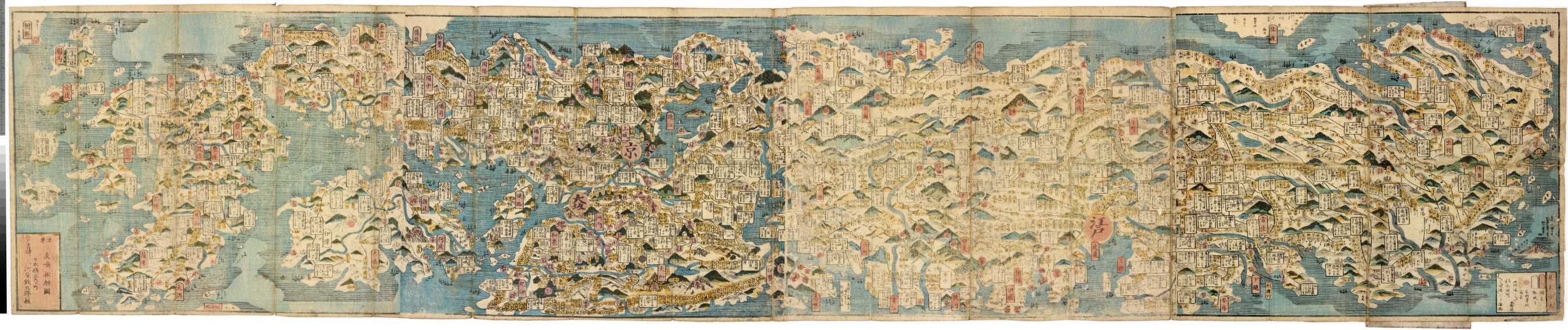
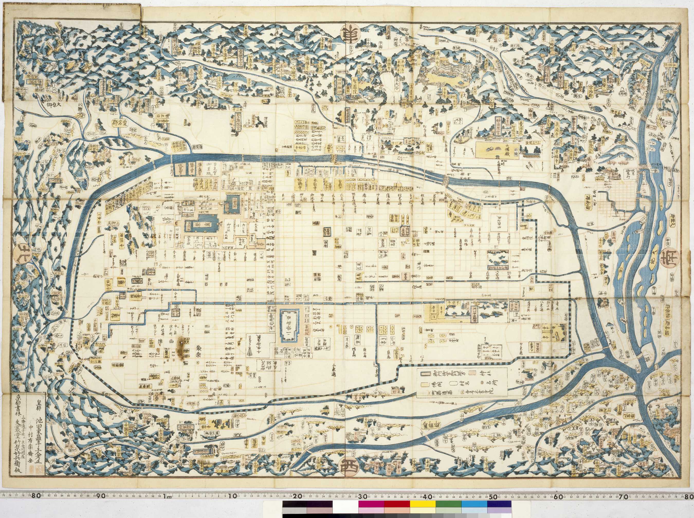
After his victory at the Battle of Sekigahara, Tokugawa Ieyasu undertook a national road-building programme with Edo (present-day Tokyo) as the focal point. Five major highways led from the new centre, Edo, all over the country with lodgings and stables at various points along the routes to cater for travelling officials and the transportation of goods on horseback. After 1635 CE regional feudal lords (daimyo) were required by law to reside every alternate year in Edo. The post stations which sprung up on the highways accommodated the daimyo travel parties on their way to and from Edo. With the development of a cash economy and the threat of conflict gone, by the middle of the Edo period, ordinary citizens participated in the business of travel. There were, however, many restrictions including travel for commoners being limited to making temple and shrine pilgrimage journeys. Travel guides were made sold folded and compact for better portability whilst travelling.

  • 04.01 万国地球与地全図 (Map of All the Countries in the World)
  • 04.01 万国地球与地全図 (Map of All the Countries in the World)
  • 2018年9月 7日
  • 04.02 石高絵図 (Illustrated Map of Land Values)
  • 04.02 石高絵図 (Illustrated Map of Land Values)
  • 2018年9月 7日
  • 04.03 日本全国道中絵図 (Illustrated Travellers' Map of All Japan)
  • 04.03 日本全国道中絵図 (Illustrated Travellers' Map of All Japan)
  • 2018年9月 7日
  • 04.04 新増細見京絵図大全 (New Detailed Illustrated Map of Kyoto)
  • 04.04 新増細見京絵図大全 (New Detailed Illustrated Map of Kyoto)
  • 2018年9月 7日
  • 04.05 日光御山之絵図 (Illustrated Map of Nikko)
  • 04.05 日光御山之絵図 (Illustrated Map of Nikko)
  • 2018年9月 7日
  • 04.06 鎌倉絵図 (Illustrated Map of Kamakura)
  • 04.06 鎌倉絵図 (Illustrated Map of Kamakura)
  • 2018年9月 7日
  • Go Top
  • ART RESEARCH CENTER
[login]

© Copyright 2017 Sainsbury Institute for the Study of Japanese Arts and Cultures