04.04 新増細見京絵図大全 (New Detailed Illustrated Map of Kyoto)
-
-
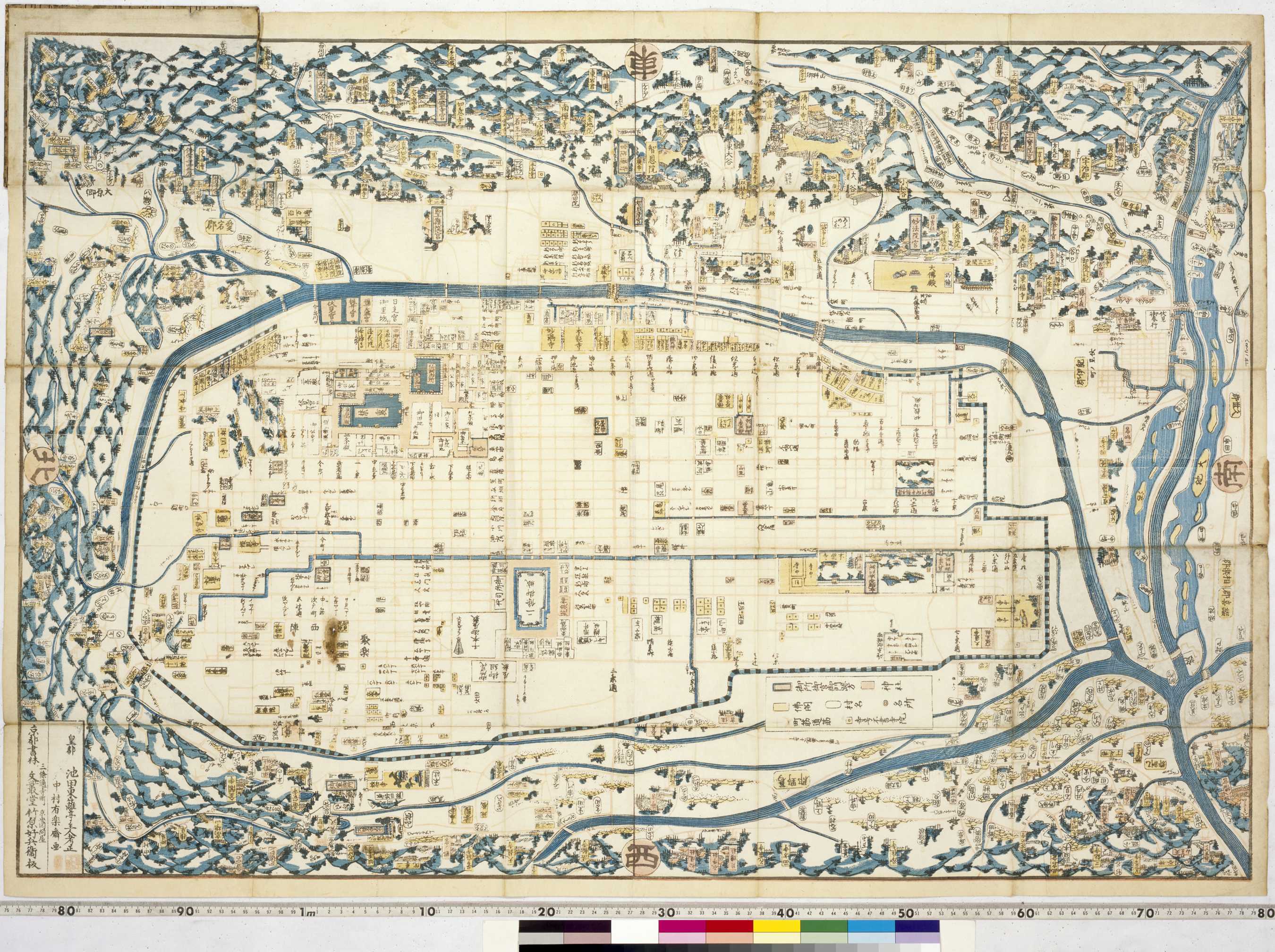
江戸図とは異なり、京の地図は、この図のように東を上にしたものが一般的である。この地図では、仏教寺院が黄色に塗りつぶされて表されている。地図上方にかなり大きく清水寺や知恩院が描かれているが、現在多くの観光客を集める金閣寺(左下)・銀閣寺(左上)は小さく描かれているに過ぎない。
Unlike city plans of Edo, it was usual for maps of the capital, Kyoto, to be oriented with east at the top. Buddhist temple grounds are coloured yellow with the large Kiyomizu and Chion-in temples clearly visible near the top, nestled in the hills east of the city. Hugely popular with visitors today, Kinkaku-ji and Ryôan-ji can be found in the northwest and Ginkaku-ji in the southeast.