04.02 石高絵図 (Illustrated Map of Land Values)
-
-
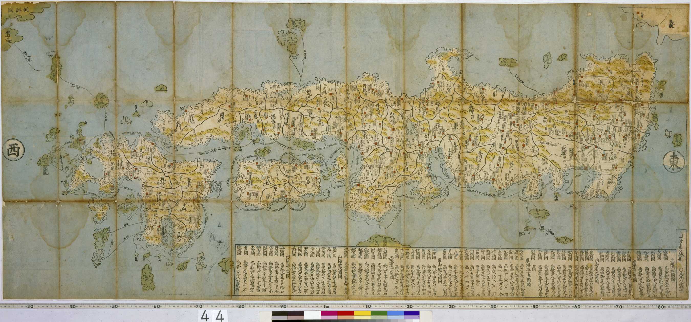
地図には、石高と藩主名、宿駅などのほか全国の主要陸海路が示されていて、旅行案内的な役割を意図した情報である。右下には国名と石高が一覧表になって表されている。この地図の作者、制作年は不明であるが、浮世絵師の石川流宣 (Ishikawa, Ryūsen) が1687年に作成した『本朝図鑑綱目』を簡略化したものと思われる。流宣の日本図は情報が豊富な上に、華麗で人々の人気を集め、およそ1世紀にわたって様々な版の「流宣図」が作られた。
ちなみに、これと同じ地図をケンペルが日本から持ち帰っている。This map shows the various domains and their agricultural land values (kokudaka), the principal land and sea routes throughout the country and various post towns, and would have been a useful map for travellers. Although the author of this map and the year of its creation are unknown, it is similar to the Honchô zukan kômoku (map of the lands of our country) made in 1687 by ukiyo-e artist Ishikawa Tomonobu (Ryûsen)(active 1680-1713).