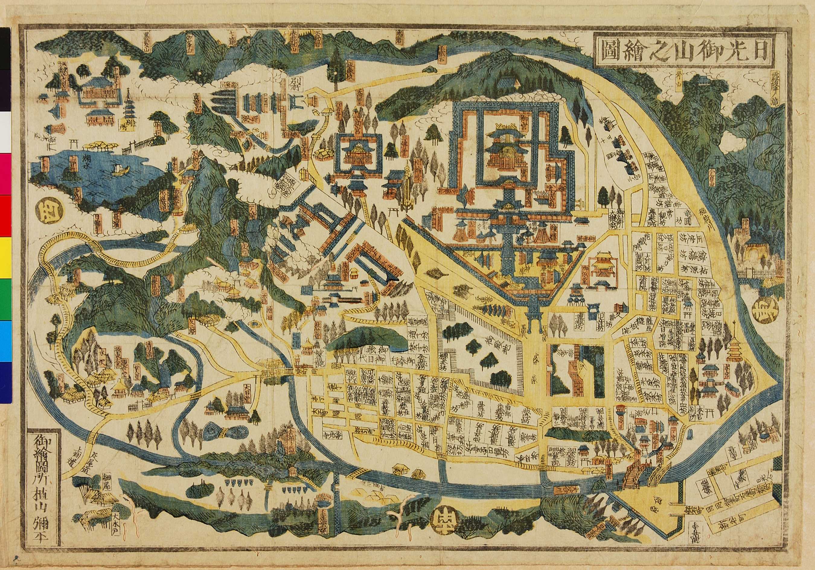
04.05 日光御山之絵図 (Illustrated Map of Nikko)
-
-
元禄年間(1688〜1704)より幕末まで、日光中鉢石町 (Naka-hatsuishi-machi) の植山弥平治(弥平)家が土産物として出版した鎌倉の鳥瞰図。この色刷り小図版のほか大図,色なしなど,多種多様な版が存在することから、江戸時代を通し多くの参拝客が日光を訪れた事が推測される。
From the Genroku era (1688-1704) until the mid 19th century, the family of Ueyama Yaheiji (Yahei), from Nakahatsuishi-machi in Nikko, published souvenir plans of the city. In addition to this smaller coloured illustrated map, there were many different kinds, some coloured, some not. These were made for the many worshippers who visited the temples of Nikko during the Edo period. Nikko had flourished as a religious centre since the 8th century CE and became the site of mausoleum shrine, Tôshô-gû, of Tokugawa Ieyasu (1543-1616), the focus of this particular map.