04.06 鎌倉絵図 (Illustrated Map of Kamakura)
-
-
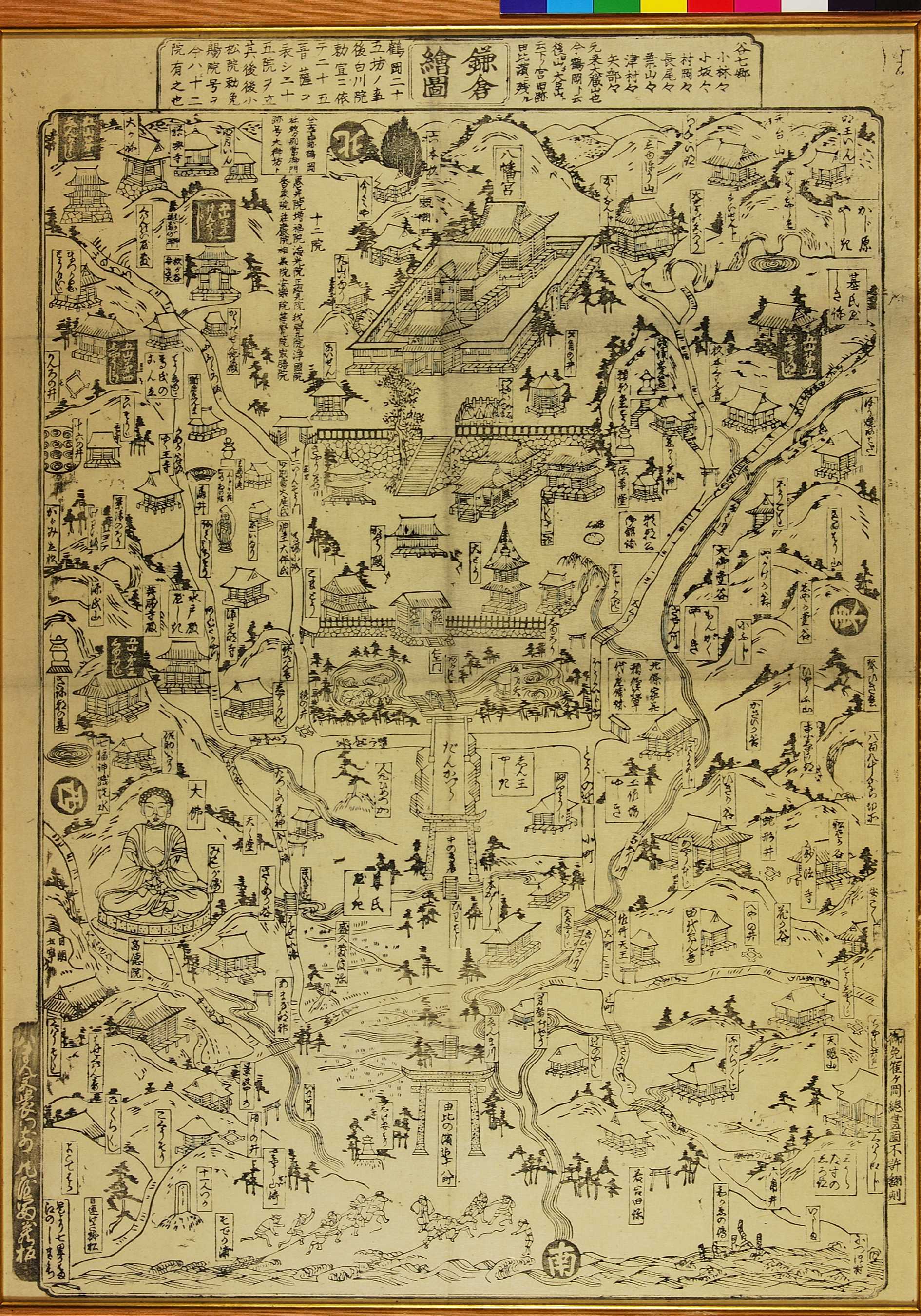
庶民の間で巻き起こった鎌倉物見遊山の大流行を反映して作られたガイドマップ。鶴岡八幡は現在は完全に神道の神社であるが、明治維新に行われた神仏分離以前には、仁王門、大塔、鐘楼堂、愛染堂、十二院など仏教的な建造物が多数存在していたことがうかがえる。
This illustrated map of Kamakura is a reflection of the rise in popularity of tourism among ordinary citizens. The centre of the map is Tsuruoka Hachiman-gû-ji, which was both a Shinto shrine and Buddhist temple. The Meiji-period (1868-1912) policy of separating Shinto and Buddhism worship meant many of the buildings and treasures noted here were lost, including the Niô Gate (whose statues were sold to another temple), pagoda and the Hall of Aizen Myôô, one of the five protectors of Shingon Buddhism.