- INFORMATION
- Applications [30]
- Data [1]
- From Office [4]
- GCOE Seminars [8]
- International Symposiums [8]
- DH-JAC2009 [46]
- Abstracts [20]
- Profiles [21]
- Time Table [2]
- DH-JAC2011 [1]
- Publications [4]
- News Letter [1]
- Research Meetings & Events [17]
- Research Members [7]
- Research Projects [1]
- scrap [0]
June 15, 2011
Kyoto-shi meisai-zu (detailed maps of Kyoto city) Workshop
We will be holding a workshop on the Kyoto-shi meisai-zu
Kyoto-shi meisai-zu (detailed maps of Kyoto city) Workshop
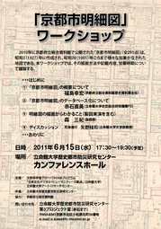 | ( |
| Time and Date: | 17:30 to 19:30 (scheduled), Wednesday, July 15, 2011 |
| Place: | Conference Hall, Research Center for Disaster Mitigation of Urban Cultural Heritage |
| Sponsored by: | MEXT Global COE Program “Digital Humanities Center for Japanese Arts and Cultures” (Ritsumeikan University), Art Research Center (Ritsumeikan University) |
| Supported by: | Research Center for Disaster Mitigation of Urban Cultural Heritage, Ritsumeikan University |
| Supported by: | Kyoto Prefectural Library and Archives |
The Kyoto-shi meisai-zu (291 maps in total) made available for public viewing at the Kyoto Prefectural Library and Archives in 2010 were first created in1927 and thereafter corrected on various occasions until 1951.
Despite a map like the one shown here—a fire insurance map—whose details can tell us a lot about the landscape in Kyoto during the modern period, much of the information on how the map was drawn and other details, including the years it was corrected, remains unclear.
To that end, we are holding a workshop to bring experts on maps and the urban structuring of Kyoto in the modern period together to discuss the possibilities of further understanding and utilizing the Kyoto-shi meisai-zu maps.
| Workshop program: | Introduction 1. On the overview of Kyoto-shi meisai-zu 2. On the compilation of a database of Kyoto-shi meisai-zu Naomi Akaishi (Postdoctoral Fellow, Kinugasa Research Organization) 3. What we can learn from the drawing of Kyoto-shi meisai-zu (includes practical map-making) Mitsutoshi Mori (Mori Tsubo) 4. Discussion Chair: Keiji Yano (Professor at the Faculty of Letters, Ritsumeikan University) |
Contact:
Project Room No. 3, Research Center for Disaster Mitigation of Urban Cultural Heritage, Ritsumeikan University (contact Akaishi-san)
58 Komatsubara Kitamachi, Kita Ward, Kyoto, 603-8341
E-mail:n-kawa■fc.ritsumei.ac.jp (change■ to @)
TrackBacks(0)
The list of blogs that refer to this blog article: Kyoto-shi meisai-zu (detailed maps of Kyoto city) Workshop
Trackback URLs to this blog article: https://www.arc.ritsumei.ac.jp/lib/mt_gcoe/mt-tb.cgi/4802

- LANGUAGES
- RECENT POSTS
- G-COE Scholarship (application period: between November 5 and 6.)
- We are pleased to announce the recruitment of Senior Researcher for Academic Year 2013. (Application Deadline: On Janyuary 18, 2013)
- G-COE Incentive Scholarship (application period: between June 14 and 20.)
- Research Members in FY2012
- Report on Harvard-Ritsumeikan Symposium on Digital Humanities
- ARCHIVES
- November 2013 [1]
- January 2013 [1]
- June 2012 [1]
- May 2012 [1]
- March 2012 [2]
- January 2012 [5]
- December 2011 [1]
- November 2011 [3]
- October 2011 [1]
- September 2011 [4]
- August 2011 [1]
- July 2011 [3]
- June 2011 [5]
- May 2011 [4]
- April 2011 [4]
- March 2011 [1]
- February 2011 [1]
- January 2011 [1]
- December 2010 [4]
- October 2010 [2]
- September 2010 [2]
- July 2010 [2]
- June 2010 [5]
- April 2010 [4]
- March 2010 [3]
- January 2010 [3]
- October 2009 [4]
- July 2009 [1]
- June 2009 [7]
- May 2009 [5]
- April 2009 [3]
- March 2009 [4]
- February 2009 [3]
- January 2009 [4]
- December 2008 [2]
- November 2008 [2]
- October 2008 [1]
- September 2008 [44]
- August 2008 [3]
- April 2008 [1]
- February 2008 [1]