-
-
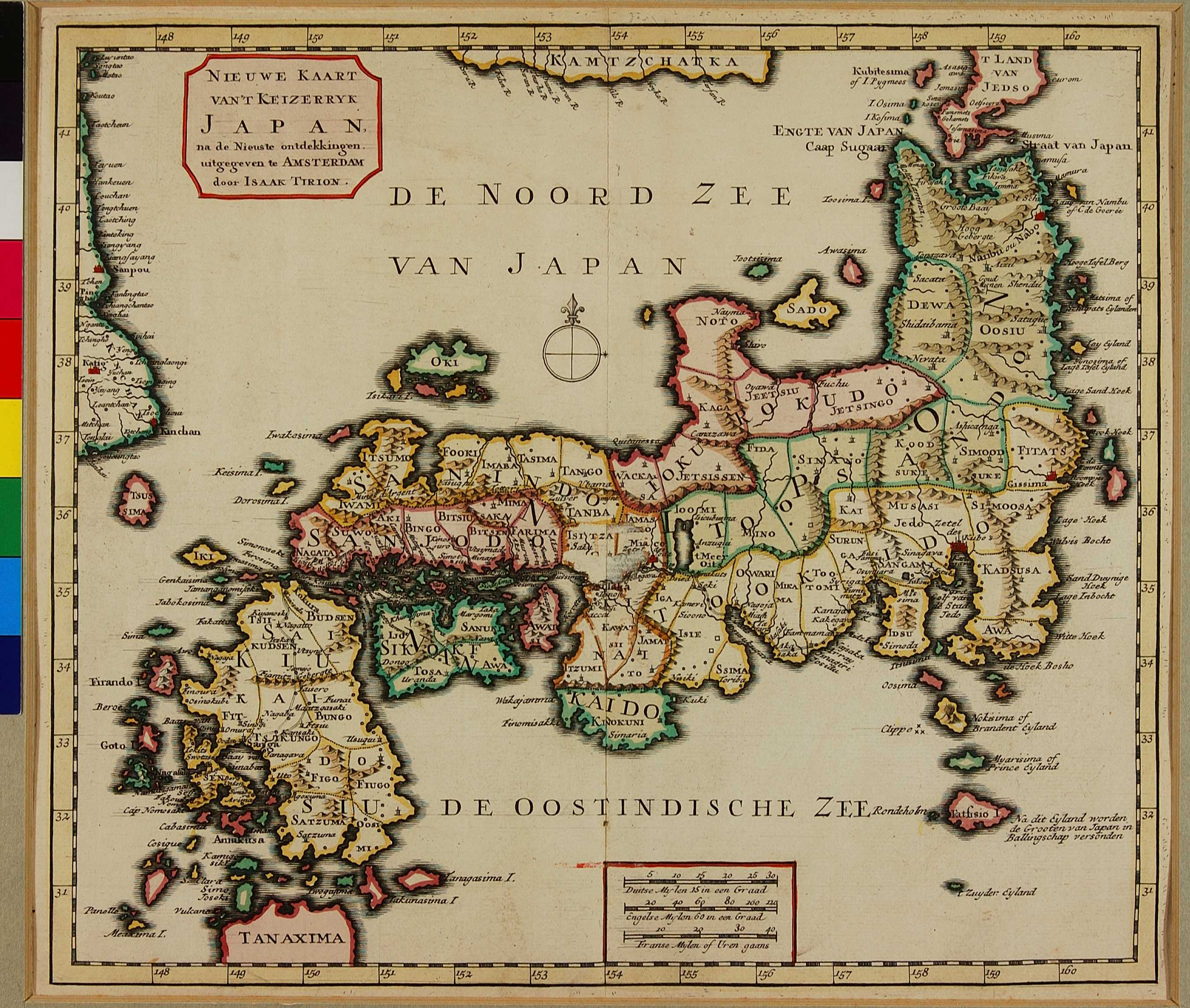
New Map of the Empire of Japan
Tirion, Isaak (1705-1765)
Copper Engraving; Amsterdam; 1736; 27.5 x 31.5 cm
Nieuwe en Beknopte Hand-Atlas1727年のケンペルの地図の影響はティリオンの日本地図にもみることができる。ドイツ人のティリオンはケンペルの構図をふまえながらさまざまな歴史的地域を加えており、その中でもドイツの輸出入業者がよく使っていた長崎から九州をぬけて本州東海道を通って江戸までいくルートを描きこんでいる。地図の左下側の地域はケンペルが琉球としたところだが、ここではTanaximaと表記されている。
The influence of Kaempfer's 1727 map can be traced in Tirion's map of Japan. Although here, the Dutchman Tirion adds the various historical regions of Japan and, importantly, draws the route regularly taken by the Dutch traders from Nagasaki through Kyushu, Honshu and along the Tokaido to Edo. At the map's lower edge is the tip of a landmass that Kaempfer identified as Ryukyu, but noted here as Tanaxima.
-
関連記事
-

05.10 Imperivm Japonicvm in Sexaginta et octo provincias Divisvm
[参考展示: 国際日本文化研究センター 貴重書データベ...
-
05.08 NIEUWE KAART VAN'T KEIZERRYK JAPAN (New Map of the Empire of Japan) [18]