-
-
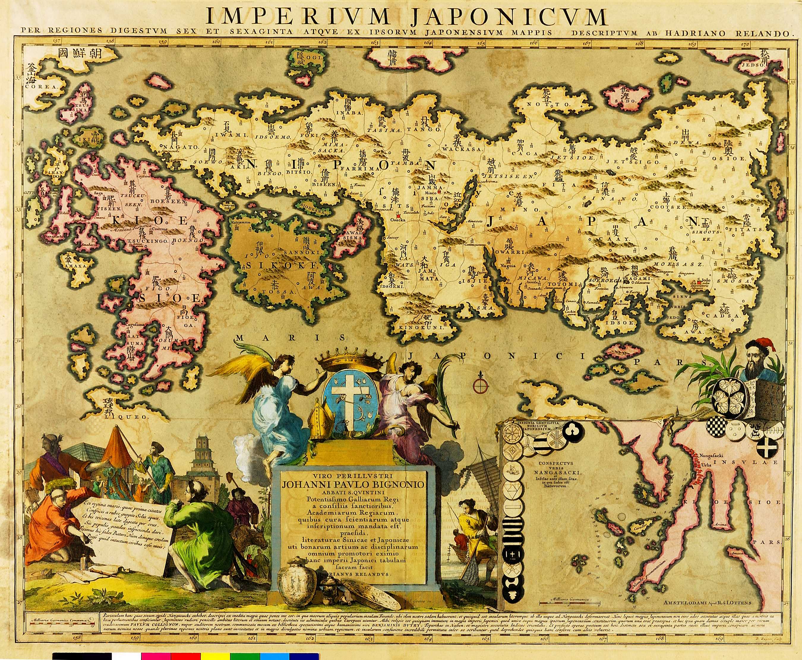
石川流宣は『本朝図鑑綱目』の刊行後、1691年に大型の『日本海山潮陸図』を作った。浮世絵師である石川流宣は、地図としての正確さよりも見た目の美しさを重要視したようで、『日本海山潮陸図』を基にして作られたAdrian Reland のこの地図は、それより以前にヨーロッパで作られた日本地図よりも、地形を表す図としての正確さにかける。しかし、その形の美しさ故に、以後何十年にもわたって、繰り返しコピーされる。右下にあるのは長崎周辺の拡大図である。
Dutchman, Adriaan Reland, used Ishikawa Ryûsen's 1961 large-scale map of Japan entitled Nihon kaisan chôriku-zu (map of Japan and the highways on land and sea) as the source for his map of Japan. It was from this time onwards that Japanese maps began to have significant influence on European mapmaking. Only the map of Nagasaki in the inset is taken from European sources; the illustrations either side of the dedication to Jean-Paul Bignon are taken from Montanus' 1669 history of Japan. Reland's map was copied many times thereafter.
05.05 IMPERIVM JAPONICVM (Empire of Japan) [15]