05.03 IAPONIA REGNVM (Kingdom of Japan) [06]
-
-
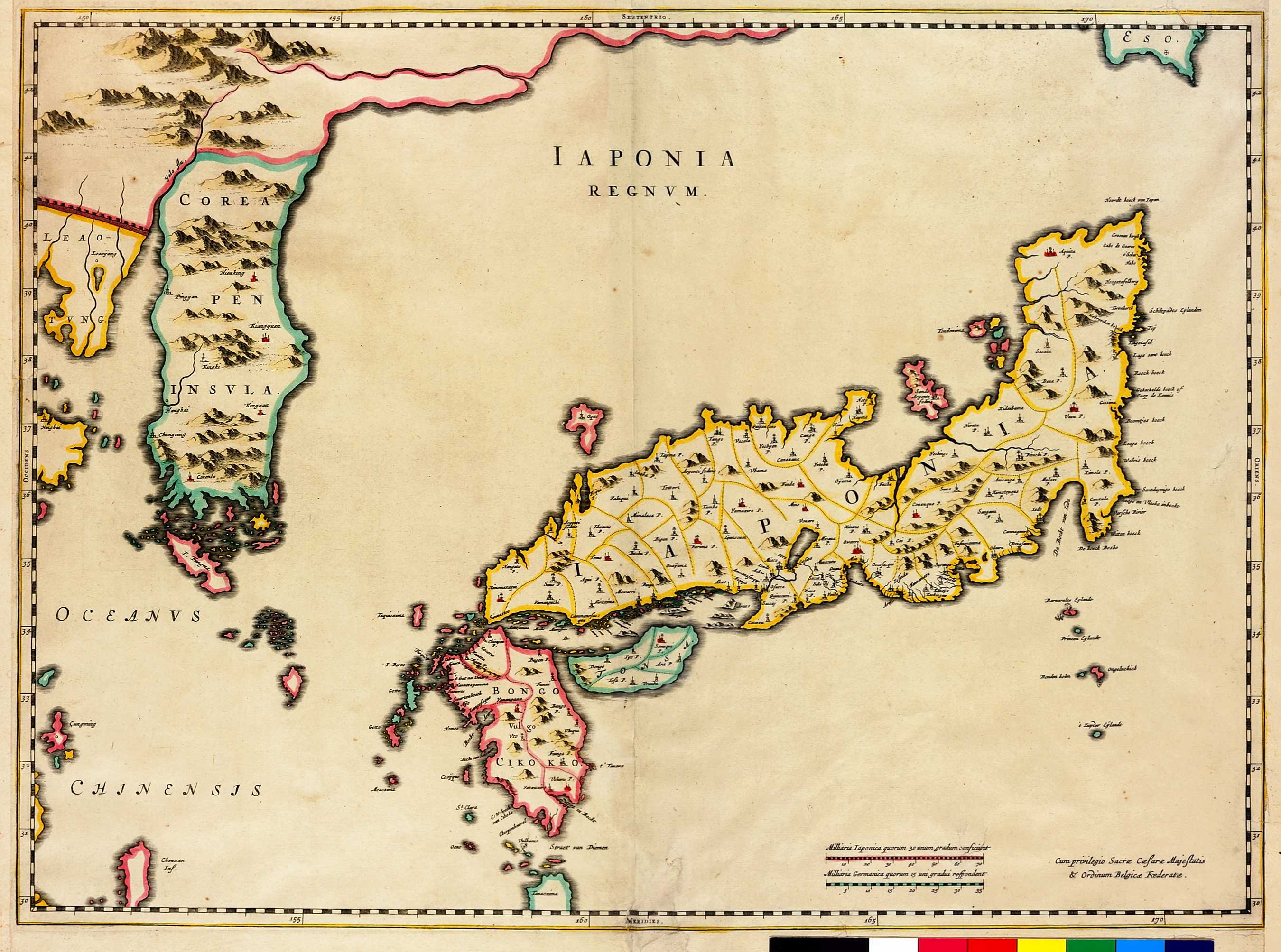
この地図を製作したイタリア人のMartino Martiniは、宣教師として1642-1651年の間、中国に滞在し、その間中に日本に関する情報を収集したようである。国境(くにざかい)線が加えられており、太平洋側の東北地方の地名や伊豆諸島などが細かく記載されている。朝鮮が半島として描かれた最初期の地図でもある。
Martino Martini was an Italian whose knowledge of Japan was gained as a result of his time as a Jesuit missionary in China (1642-1651). The boundaries between the various Japanese domains are outlined throughout the country and the Kanto Pacific coast and Izu Islands are carefully noted.