02.02 御江戸絵図 (Illustrated Map of Edo)
-
-
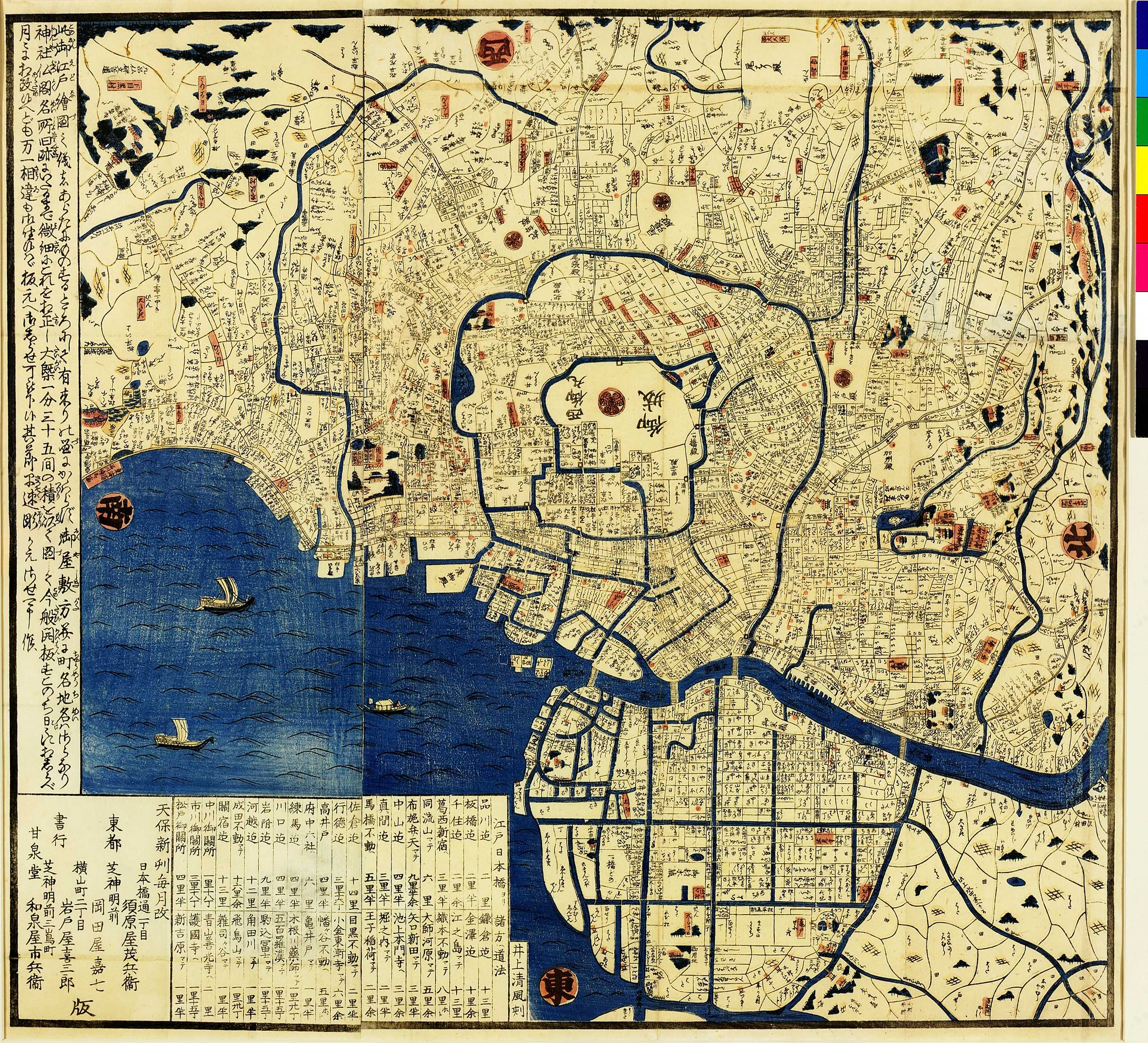
江戸時代には江戸城の内部構造は機密事項とされていたため、地図上では葵の紋所であらわされている。日本で作成された江戸図は、この地図のように西を上にするのが一般的であった。左下の表では、日本橋から江戸近郊の各地への距離数が示されている。
During the Edo period (1603-1868 CE), what lay inside the walls of Edo Castle was highly classified information. This map shows the confines of the castle represented by the three-leaved aoi Tokugawa family crest. As was common with Japanese maps of Edo, west is located at the top. The distances from Nihonbashi, the starting point of the five main highways of Japan, to various locations around the country are written in a table in the bottom left-hand corner.