02.01 Plan de Jedo (Map of Edo)
-
-
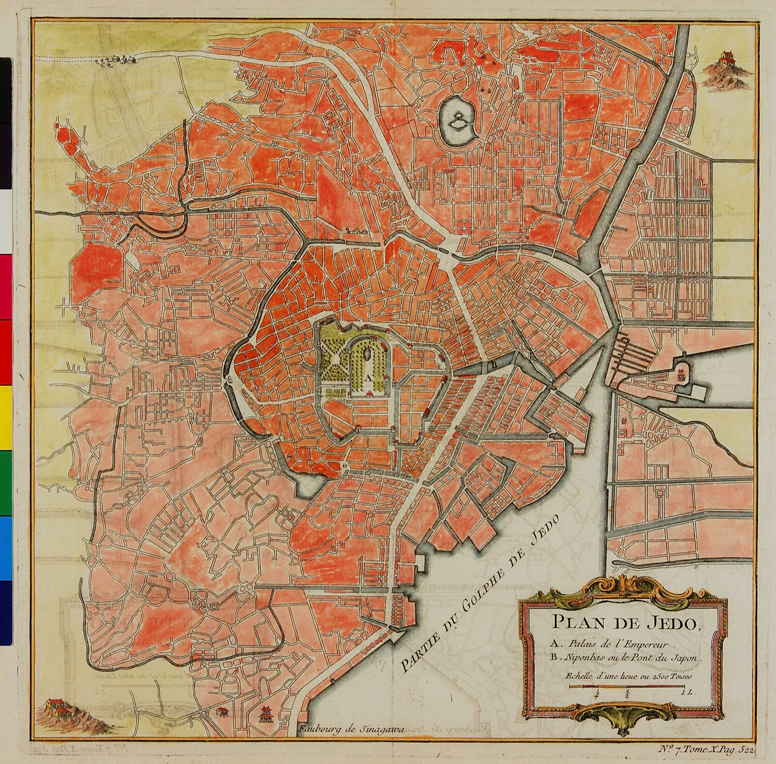
地図の中心にある江戸城には、ヨーロッパ式のフォーマル・ガーデンが表されている。戦国時代にその基礎が築かれた江戸の町は、まっすぐでない狭い道を複雑に交差させて、敵兵が容易に江戸城まで攻め込んでこられないように設計されていた。この地図にあるように直線的な道で区画整理された町とは、かなり様相を異にしていたと思われる。
Edo Castle appears at the centre of this map with an imagined European formal garden at its heart. Built during a period of almost constant nationwide military conflict in the Sengoku period (c. mid 15th - early 17th century), the city of Edo (present-day Tokyo) was a warren of narrow streets designed to confuse enemy attackers and delay any assault on the castle. The straight lines of a well-planned city, as shown here, are thought to be somewhat of a fiction.