• Historical GIS Group


1

July 1, 2011

Public web availability of the "Detailed Map of the City of Kyoto" (Kyoto Prefectural Library and Archives)

From 2/2011 on, the Historical Geographic Information Research Group, in coordination with the Kyoto Prefectural Library and Archives, will conduct digitization and GIS-conversion of the “Detailed Map of the City of Kyoto”. From 7/1, part of the result will be made public on the web, as part of the Kyoto Prefectural Library and Archives` “Library of Kyoto Memories”.

The Library of Kyoto Memories can be found at: http://kyoto-shiryokan.jp/kyoto-memory/index.php
 
We have also constructed and made available a site that shows the position of each map item on the “Detailed Map of the City of Kyoto” on Google Maps, linking to images contained in the Library of Kyoto Memories.
 
Virtual Kyoto: the “Detailed Map of the City of Kyoto” can be found at: http://www.geo.lt.ritsumei.ac.jp/meisaizu/meisaizu.html
 
An index map to the “Detailed Map of the City of Kyoto” created with GIS

June 15, 2011

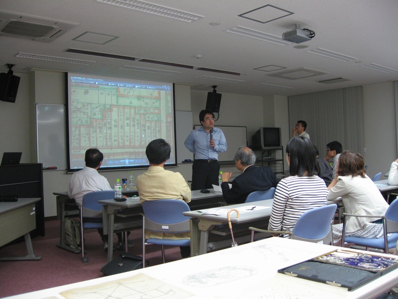
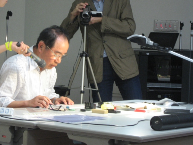
Workshop on the "Detailed Map of the City of Kyoto"

On 6/15, a workshop on the “Detailed Map of the City of Kyoto” was held in the conference hall of the Research Center for Disaster Mitigation of Urban Cultural Heritage at Ritsumeikan University. 

http://www.arc.ritsumei.ac.jp/lib/GCOE/info/2011/06/post-67.html

Taking as its material the “Detailed Map of the City of Kyoto” (291 sites total, 1:1200 scale, initial survey July 1927 with nine revisions recorded), which the Historical Geographic Information Research Group worked with the Kyoto Prefectural Library and Archives from 2/2011 to digitize and convert to GIS format, the workshop consisted of presentations and discussions about the overall nature of this resource, important issues in its study, and possibilities for future research.
 
To start off, Professor Keiji Yano, leader of the Historical Geographic Information Research Group, explained the aims of the workshop. The program continued with a talk from Yukihiro Fukushima from the Kyoto Prefectural Library and Archives, who discussed the overall appearance of the map and gave a lucid outline of many still-unclear aspects in its research.
 
Continuing on, we heard an explanation with detailed examples of the overall process of digitization and GIS-conversion and the potential for historical geographical analysis from Naomi Akaishi, a member of our research group and a post-doctoral fellow at the Kinugasa Research Organization. Mori Mitsutoshi (representative of Mori Mapmakers and part-time lecturer at Ritsumeikan University) then discussed how the “Detailed Map” was drawn, pointing out its characteristics with reference to the history of cartography in early modern to modern Japan.
 
The time left in the latter half of the workshop was all too short, but starting with comments from Makoto Yamada (Ryukoku University) and Hidekazu Watanabe (Bukkyo University), there was a lively open discussion about the historical role of the “Detailed Map of the City of Kyoto”, its significance for ongoing research, and the remaining issues in its study.
 
meisaizu2 meisaizu1

May 30, 2011

Virtual Cities workshop

On 5/31, the following workshop will be held at the University of East Anglia in Norwich, England.

From 6PM to 7PM (Japanese time), presentations will be conducted in real time using Video Conference from Yushinkan Room 443 on Kinugasa Campus. This presentation is considered a GCOE seminar extra session, so please be sure to participate.
 
Tuesday 31 May 2011
A one-day workshop in Norwich
Virtual Cities: computer modelling and simulating the urban environment in
Kyoto and Norwich

Organised by the Centre for Japanese Studies
and the School of Environmental Sciences, University of East Anglia,
Norwich, in conjunction with the Norwich Economic and Regeneration Trust (HEART)
 and the Virtual Kyoto Project, Ritsumeikan University

1st venue: Fusion and the Curve, The Forum, Norwich

18.00-19.00 Presentations and a real-time link between Kyoto and Norwich
      18:00-18:10     Introduction and welcome
      18:10-18:25     Keiji Yano (Ritsumeikan University) The digital museum of the Gion festival on Virtual Kyoto
      18:30-18:45     Sophie Cabot (Norwich HEART) HEART and the Virtual
      18:45-19:00     Discussion
 
The sessions after these will continue on location in England only.
 
For details, please consult this GCOE seminar announcement:
http://www.arc.ritsumei.ac.jp/lib/GCOE/seminar/2011/05/vol19gcoe.html

April 1, 2011

Publishing of "Historical GIS of Kyoto"

“Historical GIS of Kyoto”, by the members of Historical Geographic Information Research Group, has been published by Nakanishiya Press as the third volume in the series “Series: Japanese Culture Digital Humanities”.

For details, please see the link below.

Supervised by the Ministry of Education, Culture, Sports, Science and Technology Global COE Program, Digital Humanities Center for Japanese Arts and Culture (Ritsumeikan University)

Editors: Keiji Yano, Tomoki Nakaya, Tatsunori Kawasumi, Satoshi Tanaka

 http://www.arc.ritsumei.ac.jp/lib/GCOE/info/2011/03/gis-1.html

1


  • Recent Entries

  • Archive


center's new seminar
GCOE Seminor Discussion
GCOE Activity and Records
Trends of DH
E-journal
21CenturyCOE
Introduction Movie
Links