-
-
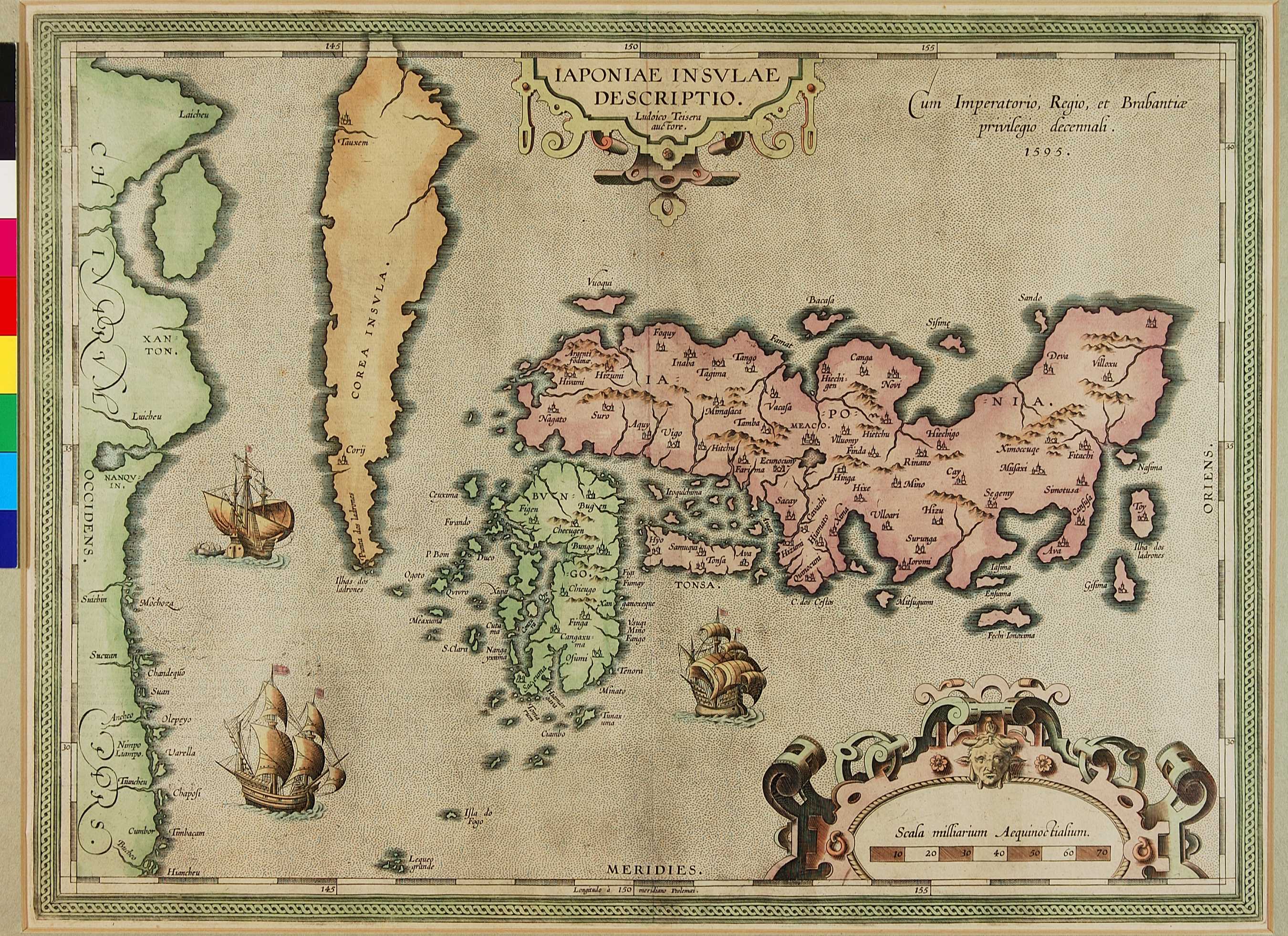
日本を単独で描いた地図としては、本州、九州、四国をほぼ正確な形で表されたヨーロッパで初めての地図で、オーテリウスが作成した。この地図は、行基図を基に多少の修正を施して作成されたと思われる。地名の記入位置にほとんど誤りがない。16世紀の銀の輸出は重要であり、ここでは岩見銀山の位置が強調されている。北海道はなく、朝鮮は島のように描かれている。この地図の出版以降、この形が日本地図の定型として繰り返し使われるようになる。
Ortelius was the first in Europe to create a fairly accurate representation of Japan showing the islands of Honshu, Kyushu and Shikoku. It would appear to have been modeled on an earlier Japanese gyôki map and the towns and cities are not so drastically misplaced. The importance of the silver trade for Japan in the 16th century is highlighted by reference to the famous Argenti fodiane or silver mines of Iwami (here called Hivami). Hokkaido has not been included, and after its publication, this particular map fixed the shape of Japan for some time to come.
05.01 IAPONIAE INSVLAE DESCRIPTIO (Island Of Japan) [2]